Old maps and new aerial photos, lined up on the same ground
Each print puts a town on its earliest USGS survey map, a mid-century USGS map and a recent aerial photo, side by side and aligned so the same streets sit in the same place. They are real maps, restored from the U.S. Geological Survey's scans of the original sheets, not illustrations.
Checkout opens in a few days. One price, $9.99, for all 22 towns: 44 high-resolution files (300 dpi JPG), instant download.
Towns
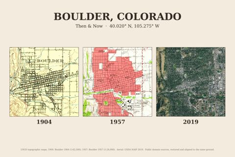
Boulder, Colorado
1904 · 1957 · 2019
1904 · 1957 · 2019
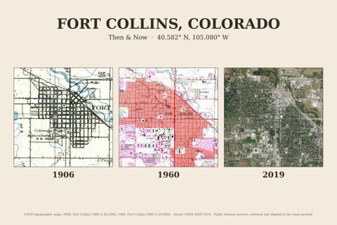
Fort Collins, Colorado
1906 · 1960 · 2019
1906 · 1960 · 2019
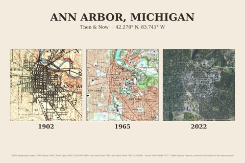
Ann Arbor, Michigan
1902 · 1965 · 2022
1902 · 1965 · 2022
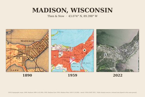
Madison, Wisconsin
1890 · 1959 · 2022
1890 · 1959 · 2022
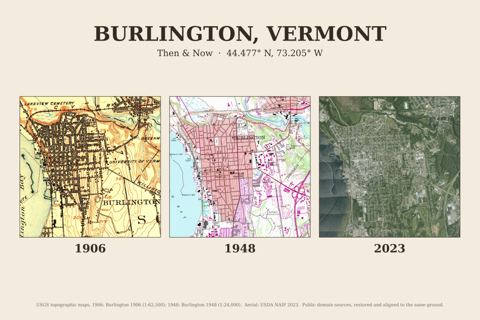
Burlington, Vermont
1906 · 1948 · 2023
1906 · 1948 · 2023
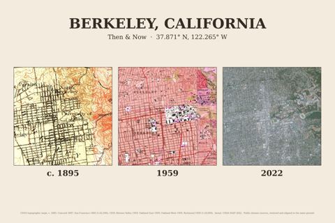
Berkeley, California
c. 1895 · 1959 · 2022
c. 1895 · 1959 · 2022
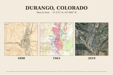
Durango, Colorado
1898 · 1963 · 2019
1898 · 1963 · 2019
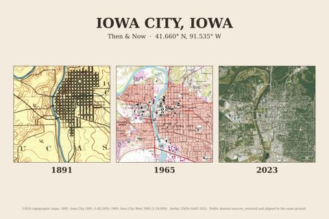
Iowa City, Iowa
1891 · 1965 · 2023
1891 · 1965 · 2023
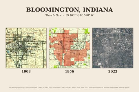
Bloomington, Indiana
1908 · 1956 · 2022
1908 · 1956 · 2022
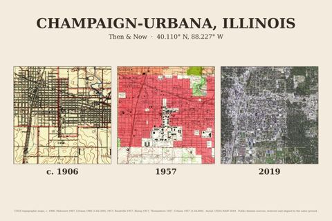
Champaign-Urbana, Illinois
c. 1906 · 1957 · 2019
c. 1906 · 1957 · 2019
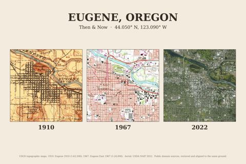
Eugene, Oregon
1910 · 1967 · 2022
1910 · 1967 · 2022
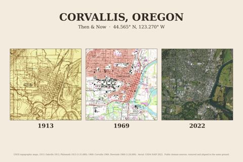
Corvallis, Oregon
1913 · 1969 · 2022
1913 · 1969 · 2022
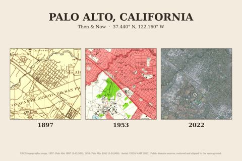
Palo Alto, California
1897 · 1953 · 2022
1897 · 1953 · 2022
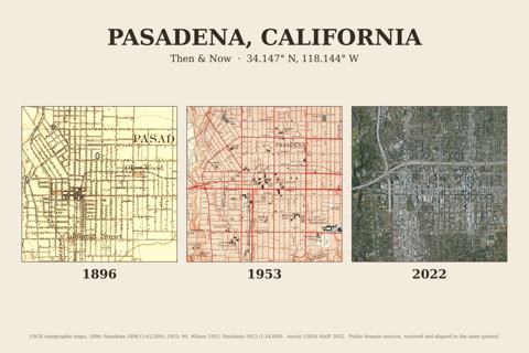
Pasadena, California
1896 · 1953 · 2022
1896 · 1953 · 2022
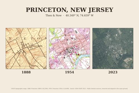
Princeton, New Jersey
1888 · 1954 · 2023
1888 · 1954 · 2023
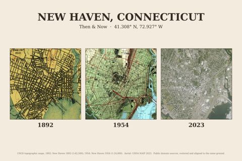
New Haven, Connecticut
1892 · 1954 · 2023
1892 · 1954 · 2023
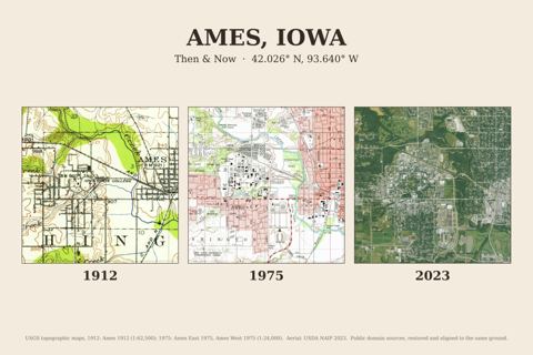
Ames, Iowa
1912 · 1975 · 2023
1912 · 1975 · 2023
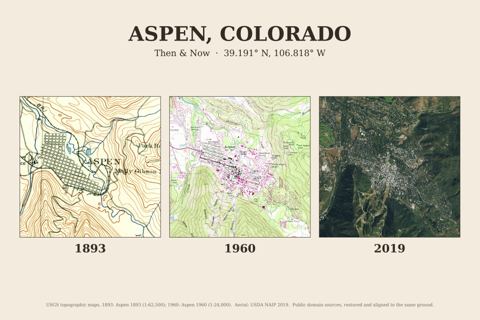
Aspen, Colorado
1893 · 1960 · 2019
1893 · 1960 · 2019
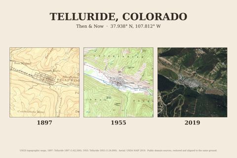
Telluride, Colorado
1897 · 1955 · 2019
1897 · 1955 · 2019
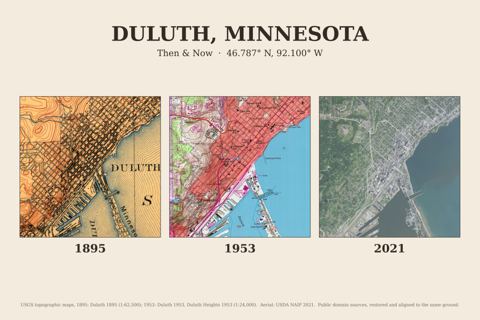
Duluth, Minnesota
1895 · 1953 · 2021
1895 · 1953 · 2021
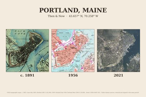
Portland, Maine
c. 1891 · 1956 · 2021
c. 1891 · 1956 · 2021
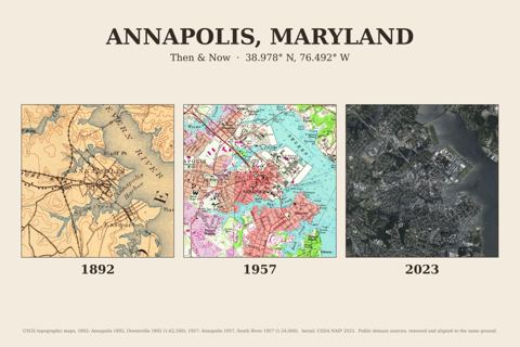
Annapolis, Maryland
1892 · 1957 · 2023
1892 · 1957 · 2023
How it works
- Pay once with Stripe. You go straight to your download page; bookmark it.
- Download the files for any town (or all of them).
- Print at home on matte paper or upload to any photo or print shop. Nothing is shipped.